Popular Posts
-
 http://www.youtube.com/watch?v=-H0_vlUheyc&feature=player_embedded அமல னாதிபிரா னடியார்க் கென்னை யாட்படுத்த விமலன் , விண்ண...
 -
வார்த்தைகளால் வர்ணிக்க முடியாத கொடைக்கானல் வார்த்தைகளால் வர்ணிக்க முடியாத இயற்க்கையின் வண்ணக் கோலம் கொடைக்கானல். 2133 மீட்டர் உயரத்தில் உ...
-
முக்கடலும் சங்கமிக்கும் கன்னியாகுமரி [ Tues, Aug 24, 2010, 04:55 pm ] பரப்பளவு - 4,433 சதுர கி.மீட்டர் சென்னையிலிருந்து 7...
-
 அழியாத எழிலோவியம் - அஜந்தா இந்தியாவின் மகாராஷ்டிரா மாநிலத்தின் அஜந் தா எனும் ஊரில் உள்ள குகைகளில் இயற்கை முறையில் வரைந்தஓவியங்...
 -
 Himalaya Beauty Himalaya Beauty The Himalaya is a mountain range in Asia, separating the Indian subcontinent from the Tibetan Plate...
 -
 Aamby Valley City [India] A amby Valley City is the first of its kind Megalopolis, spread over more than ten thousand undulating acres of v...
 -
 தஞ்சைப் பெரிய கோயில்: ஆயிரம் ஆண்டு அற்புதம் 25 Sep 2010 தஞ்சாவூர் வரலாற்று முக்கியத்துவம் வாய்ந்த சோழர்களின் தலைநகரம். இங்குதான் கடைச்...
 -
 Indonesia The Republic of Indonesia, the world's fourth most populous nation, has 203 million people living on nearly one thousand per...


Saturday, September 4, 2010
Western Ghats - பசுமை நிறை மேற்குத் தொடர் மலையின் கவினுறுங் காட்சி! காணக் கண் கோடி வேண்டும்.
Western Ghats and South India காணக் கண் கோடி வேண்
Western Ghats - பசுமை நிறை மேற்குத் தொடர் மலையின் கவினுறுங் காட்சி! காணக் கண் கோடி வேண்டும்.
Western Ghats and South India
காணக் கண் கோடி வேண்
Western Ghats and South India
The Western Ghats has been designated as a world heritage site by the United Nations. The mountain chain is recognised as one of the world's eight "hottest hotspots" of biological diversity. The chain's forests, which are older than the Himalaya mountains influence the Indian monsoon weather pattern.


கொடைக்கானல் 


மேற்குத்தொடர்ச்சி மலைகள் இமயத்தைவிட காலத்தினால் மூத்தது. இந்த மலைத்தொடரில் 126 ஆறுகள், பல சிற்றாறுகள், 29 பெரிய நீர்வீழ்ச்சிகள், சுணைகள், 50க்கும் அதிகமான அணைக்கட்டுகள் மற்றும் கொடைக்கானல், உதகை, மூனார், நீலகிரி போன்றபல மலைவாசஸ்தலங்கள், பசுமை நிறைந்த காடுகளை கொண்டடங்கியது.
தமிழ் பிறந்த தொட்டிலாக தென்கோடியில் அகஸ்தியர் வாழ்ந்த பொதிகை மலையிலிருந்து வரும் தென்றலுக்கு இணையாக எதுவுமில்லை. மாமதுரைப் பாண்டியன் அவையில் நீதிகேட்டு இறுதியில் கற்புக்கரசி கண்ணகி சென்றது மேற்குத்தொடர்ச்சி மலைப்பள்ளத்தாக்கில் அமைந்துள்ள கம்பம் பகுதிக்கே!
யுனஸ்கோ நிறுவனத்தால் உலகின் பாரம்பரியம் மிக்க சின்னமாக 2011ம் ஆண்டு மேற்குத் தொடர்ச்சி மலை அறிவிக்கப்பட்டது. இம்மலைத்தொடரில் எத்தனையோ அற்புதங்கள், மனத்திற்கேற்ற ரம்யமான அமைதி, புதிய உலகம், அரியகாட்சிகள் , கானுயிரிகள், நிறைந்து மனத்துயரத்தைப் போக்கும் மாமருந்துதான் இம்மலைத்தொடர்.
குஜராத் மாநிலம் துவங்கி மகராஷ்ட்ரம், கோவா, கர்நாடகம், கேரளம், தமிழகம் குமரிமுனை வரை 1200 கீ.மீ மேலாக தொடர் சங்கிலி போல நீண்டு தென்னிந்தியாவின் பாதுகாப்பு அரணாக விளங்குகின்றது மேற்குத் தொடர்ச்சி மலைகள். அரபிக்கடலிலிருந்து வரும் காற்றைத் தடுத்து தீபகற்ப இந்தியாவிற்கு மழைப் பொழிவைத் தருகின்றது.
இம்மலைத்தொடரில் 7402 பூக்கும் தாவரங்களும், 1814 பூக்காத தாவரங்களும், அருமருந்தாக அமைந்த பல மூலிகைச் செடிகளும் -மரங்கொடிகளும், 6000வகையான பூச்சிகளும், 10 வகையான காட்டுத் தேனீக்களும், 508வகை பறவை இனங்களும், 179 இருவாழ் உயிரினங்களும், 290 வகையான அரியமீன்களும், அதிக அளவில் யானைகளையும் கொண்ட பகுதியாக இருக்கின்றது.
The Western Ghats has been designated as a world heritage site by the United Nations. The mountain chain is recognised as one of the world's eight "hottest hotspots" of biological diversity. The chain's forests, which are older than the Himalaya mountains influence the Indian monsoon weather pattern.

The Western Ghat lie roughly parallel to Indian West Coast.

Annual Rainfalls over the Western Ghats
Western Ghats near Mathern (Mumbai) Maharashtra
Western Ghats in monsoon climate in Maharashtra
Western Ghats near Pune (Poona), Maharashtra
World famous Jog Falls, Shimoga district Karnataka
Shola Grasslands Forest Kudremukha National Park near Mangalore, Karnataka
Panoramic view of Tadiandamol - 1,750 metres (5,740 ft) at Kodagu (Coorg) District (Eastern slopes) of Karnataka
Talakaveri, origin of the river Kavery, Kodagu, Karnataka
Abbi/Abbey Falls, Kodagu, Karnatka
Thalakavery Wildlife Santuary, Kodgu, Karnatka
Kavery River - Hogenakkal Waterfalls in Dharmapuri district, Tamil Nadu
Chinnar Wildlife Sanctuary, Anamalai Hills, Kerla Tamil Nadu
A view of Anamudi, the highest peak of western Ghats (2,695 metres (8,842 ft)) from Eravikulam National Park, Kerala.
Neelagiri Hills, Home to "Nilagiri Thaars" "Neelakurinjis".
Neelagiri Hills, Tamilnadu
Agasthyakoodm Peak, Kerala
Western Ghats near Rajapalayam, Kerala
Ponmudi Hills in Thiruvananthapuram district, Kerala
View of the Western Ghats at Keeriparai, Kanyakumari, near the southern end of the range
தெங்கும் நெல்லும் கொங்கண் கிராமத்தில்
மலையடிவாரக் கிராமம்.
கிராமத்தில் தடாகம்
நாற்று நடுகை
மலைப்பாதை.
முகில் கிரீடம் சூடிய மலை முகடு.
வழிந்தோடும் நீரோடை
மலைக் காட்டினுடே மலைப்பாதை
கணவாயைக் கடக்கும் தார் ரோடு

மலையை மறைக்கும் வெண்மேகம்.

பசும் போர்வை - போர்த்தியது யார்.

தென்னந்தோப்பு
 |
| தென்னந்தோப்பு |

 |


Wednesday, September 1, 2010
Himalaya Beauty
Himalaya Beauty
Himalaya Beauty
The Himalaya is a mountain range in Asia, separating the Indian subcontinent from the Tibetan Plateau. By extension, it is also the name of the massive mountain system which includes the Himalaya proper, the Karakoram, the Hindu Kush, and a host of minor ranges extending from the Pamir Knot. Together, the Himalayan mountain system is the planet's highest and home to all 14 of the world's highest peaks, the Eight-thousanders, including Mount Everest. To comprehend the enormous scale of Himalayan peaks, consider that Aconcagua at 22,841 feet (6962 m) is the highest mountain in the Andes, while there are over thirty peaks in the Himalaya exceeding 25,000 feet (7620 m).
Etymologically Himalaya means "abode of snow" in Sanskrit ( from hima "snow", and aalaya "abode"). The correct name for the range is Himalaya, though the plural Himalayas is often used.

 The Himalaya stretch across five nations — Pakistan, India, China, Bhutan and Nepal. It is the source of two of the world's major river systems — the Indus Basin and the Ganga-Brahmaputra Basin. An estimated 750 million people live in the watershed area of the Himalayan rivers, which also includes Bangladesh.
Tsongmo lake near the Indo-China border in Sikkim

The Himalayan (pronounced as Himaalayas and not with a short "a" as is commonly mispronounced)range runs for about 2400 km, from Nanga Parbat in the west to Namche Barwa in the east. The width varies between 250-300 km. The Himalayan range comprises three parallel ranges, arranged by elevation and geological age.


Gurudogmar Lake, with the Gurudogmar peaks in the backdrop

பனி படர்ந்த இமயமலை முகட்டில் பசுமையான தேயிலைத் தோட்டம்
 பனி படர்ந்த இமயமலை முகட்டில் பசுமையான தேயிலைத் தோட்டம் - டார்ஜிலிங்


பசுமையான தேயிலைத் தோட்டங்கள்.


Himalaya Beauty
The Himalaya is a mountain range in Asia, separating the Indian subcontinent from the Tibetan Plateau. By extension, it is also the name of the massive mountain system which includes the Himalaya proper, the Karakoram, the Hindu Kush, and a host of minor ranges extending from the Pamir Knot. Together, the Himalayan mountain system is the planet's highest and home to all 14 of the world's highest peaks, the Eight-thousanders, including Mount Everest. To comprehend the enormous scale of Himalayan peaks, consider that Aconcagua at 22,841 feet (6962 m) is the highest mountain in the Andes, while there are over thirty peaks in the Himalaya exceeding 25,000 feet (7620 m).
Etymologically Himalaya means "abode of snow" in Sanskrit ( from hima "snow", and aalaya "abode"). The correct name for the range is Himalaya, though the plural Himalayas is often used.


Tsongmo lake near the Indo-China border in Sikkim

The Himalayan (pronounced as Himaalayas and not with a short "a" as is commonly mispronounced)range runs for about 2400 km, from Nanga Parbat in the west to Namche Barwa in the east. The width varies between 250-300 km. The Himalayan range comprises three parallel ranges, arranged by elevation and geological age.


The Himalayan range at Yumesongdong in Sikkim, in the Yumthang River valley.


Gurudogmar Lake, with the Gurudogmar peaks in the backdrop

பனி படர்ந்த இமயமலை முகட்டில் பசுமையான தேயிலைத் தோட்டம்
 பனி படர்ந்த இமயமலை முகட்டில் பசுமையான தேயிலைத் தோட்டம் - டார்ஜிலிங்
நெளிந்து வளைந்து கிடக்கும் மலைப் பாம்பு மலைப் பாதை.


பசுமையான தேயிலைத் தோட்டங்கள்.


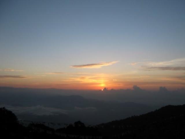
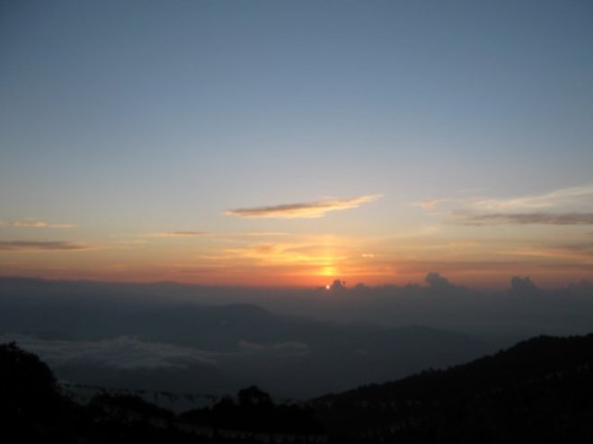
உதய சூரியன்

டார்ஜிலிங் தேயிலைத் தோட்டங்கள்

ரம்மியமான மலைச்சரிவு

பசுமைப் போர்வை

மலைமுகட்டில் சலசலத்து இறங்கும் நீரோடை

மேகங்கள் முட்டி மோதும் மலையருவி


பச்சை வரிக்குதிரையாக மலைச்சரிவில் தேயிலைத் தோட்டங்கள்.

வரு... சாரே! சாய் களிக்காம்

கொழுந்துத் தேயிலை

ஊர்ந்து செல்லும் பொம்மை ரயில்ப் பாதை.


ஆர்ப்பரித்து இறங்கும் கானருவி

தேயிலைத் தோட்டம்

மலை ரயில்.

தெளிந்த நீர்த்தேக்கம்


தோட்டத் தொழிலாளிகள்

Subscribe to:
Posts (Atom)